Geospatial Data Management/GIS
Overlaying historical information on current aerials
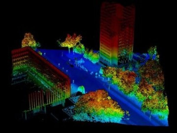
Using lidar to calculate differences (areas, volume)
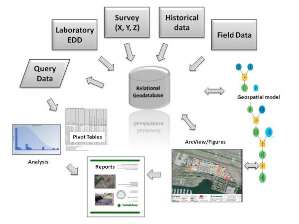
Using geospatial data management to visualize the problem
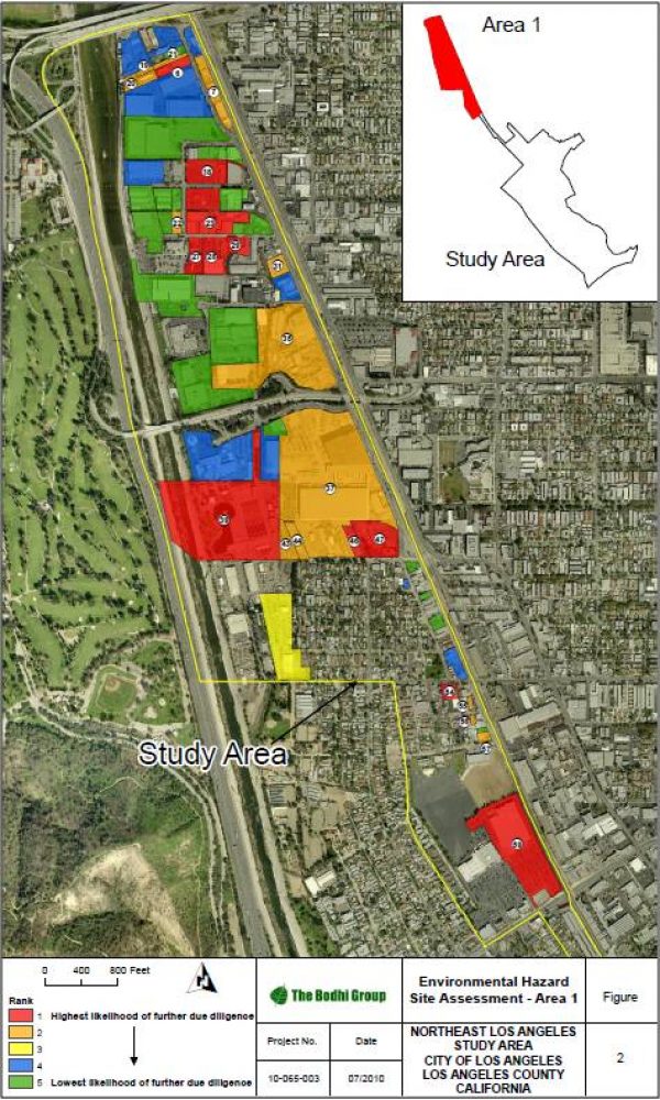
Environmental impacts on communities in Los Angeles
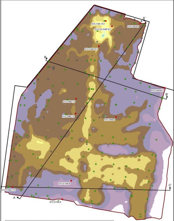
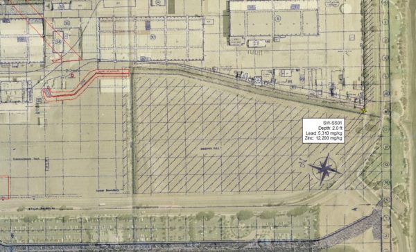
Mapping NTC landfill remedial excavation and confirmation samples
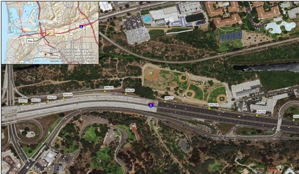
Statistical analysis of lead along San Diego freeways
The Bodhi Group is a pioneer in using relational databases integrated with Geographic Information Systems to persist, query, and present large volume environmental big data. We leverage information technology to increase efficiency, decrease errors, and compress schedules on all our projects – whether it is a historical search to identify contaminant sources or geospatially relate chemical properties and physical features to help our clients develop the most appropriate design for site redevelopment.
- Integrate normalized laboratory chemistry data and legacy data with GIS spatial features to visualize contaminant impacts, fate, and transport
- Query databases to identify hot spots, statistically evaluate confidence means, and determine trends
- Leverage geostatistical methods such as kriging to incrementally determine coverage
- Use GIS as an analytical tool, presentation tool, field mapping tool, and conversion tool (CAD and Google Earth) to deploy geospatial data to mobile devices (iPhone, Android)
- Integration of electronic data with powerful visual GIS tools is a game changer for litigation and negotiation
- Example projects:
Hazardous Waste Services On-Call , Caltrans District 11 San Diego and Imperial Counties
Chula Vista Bayfront Master Plan