Geotechnical Desktop Studies

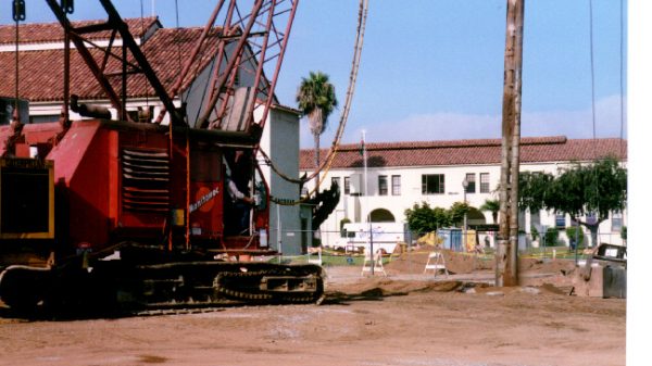
Installing rock anchors with Clemson rig
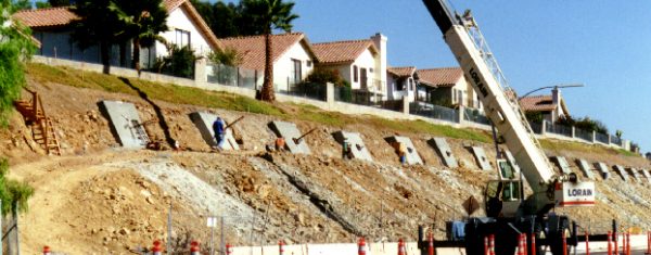
Post-tensioned rock anchors for slope stabilization
Installing stone columns to mitigate liquefaction

Mapping seismic fault and liquefaction zones

Mapping regional geology
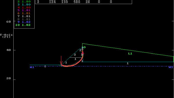
Slope stability analysis
The Bodhi Group routinely performs geotechnical and geologic desktop studies to identify geotechnical conditions or geologic hazards that might affect proposed capital and redevelopment projects, and community updates.
- Review of relevant published geologic maps, State issued geologic hazard maps, the City of San Diego Seismic Safety Study Geologic Hazard and Fault maps
- Comparison of site hazards with those listed in the “Guidelines for Geologic/Seismic Consideration in Environmental Impact Reports,” California Geological Survey (California Division of Mines and Geology) Note 46, “Guidelines for Preparing Geologic Reports for Regional-Scale Environmental and Resource
- Management Planning,” California Geological Survey (California Division of Mines and Geology) Note 52
- Modeling deterministic seismic analysis of known active faults within 100 kilometers of the study area using programs such as EQFAULT and FRISKSP. Searching for historical seismicity data using EQSEARCH
- Preparation of maps in GIS showing distribution of surficial deposits and geologic unit and areas susceptible to geologic hazards, such as liquefaction, surface rupture, slope instability, coastal bluff retreat, tsunami inundation, flooding, and settlement